







One map. Every device. Any capture.

MultiSet turns any source, any scanner, any sensor, the 3D data you already own, or none at all into one live map your cameras, robots, and agents localize and track against in real time. Your data. Your cloud. No lock-in.
Bring any scanner. We partner with all of them.

Agnostic on every axis.

Scan-agnostic: what you feed in

Any format or scanner builds the map: E57, LiDAR, 360 video, textured meshes, MatterPak, Gaussian splats. Keep your hardware.

Sensor-agnostic: what localizes

Any device localizes and tracks: phone, headset, robot camera, LiDAR, 360, drone today; anything that sees tomorrow.

Map-agnostic: what you localize against

Any 3D data is a map: point clouds, meshes, 3D tiles, splats, GIS layers, digital twins. Even data you didn't capture.

Vendor-agnostic: who you're tied to

Any capture vendor, any cloud, any deployment. Your data never becomes our model. No lock-in.

Your digital twin can't tell a device where it is.

MultiSet turns the as-built data you already own, your single source of truth, into a live coordinate system every device localizes and tracks against.

Three ways to get a VPS map

Bring Any Scan
Use the scanner you already own. Keep your hardware. Keep your workflow.
Supported Formats
Managed Capture
No scan yet? We'll capture it for you through our global network of capture partners.
Talk To Us
Capture It Yourself
Prototype in minutes. Scan on the spot with the MultiSet app on iOS Pro.
Get iOS App

Different scanner for every zone. One map underneath.

No 3D data yet? Capture it.

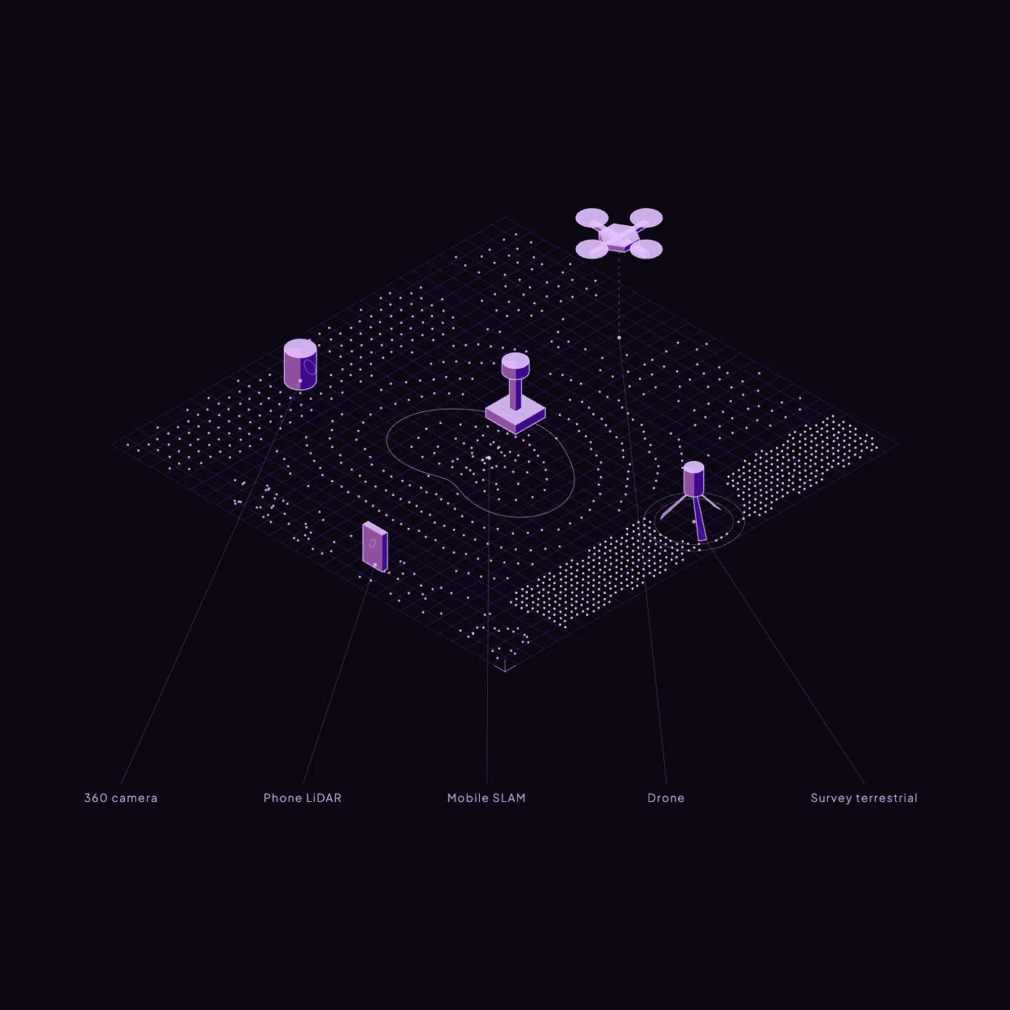
Use a drone outside, an AMR through corridors, a survey rig where detail matters, a phone for the rest. Every scan merges into a single VPS-ready map on one coordinate system. Choosing the right tool per zone is the only real decision.
Learn about reality capture
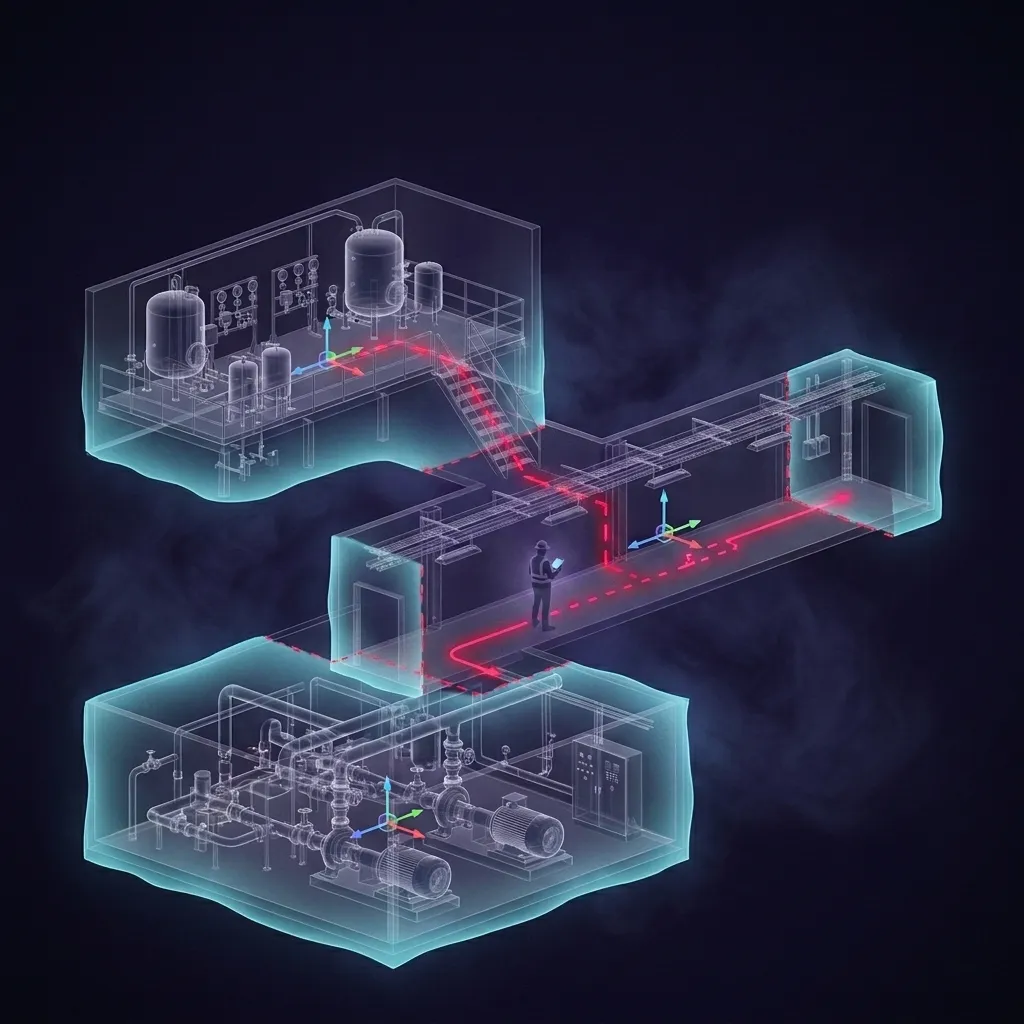
Three levels of an industrial facility drawn as cutaways held in one shared coordinate frame, a technician with a tablet on the middle level, and a red route running between the levels
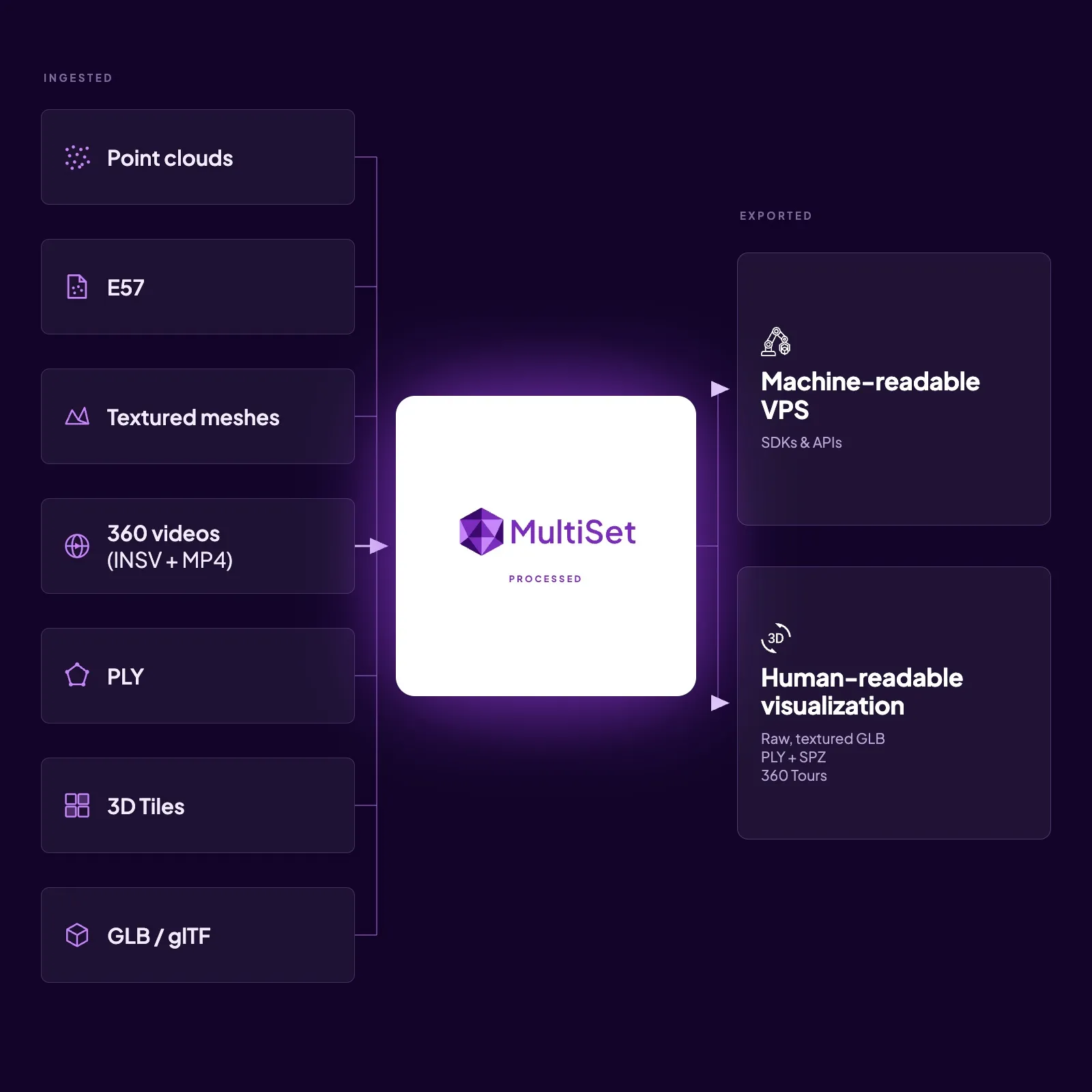
Point clouds, E57, textured meshes, 360 videos, PLY, 3D Tiles and GLB or glTF ingested into MultiSet, which exports a machine-readable VPS with SDKs and APIs alongside a human-readable visualization as GLB, PLY, SPZ and 360 tours

Already have 3D data? Localize against it.

Point a camera at a space you've captured before and MultiSet places the device inside it, in real time.

Point clouds, meshes, tiles, splats, GIS layers you already own. No re-scan, no conversion project. The data you've been collecting for years becomes a live positioning layer.
Learn about localization

One capture. Two ways to use it.

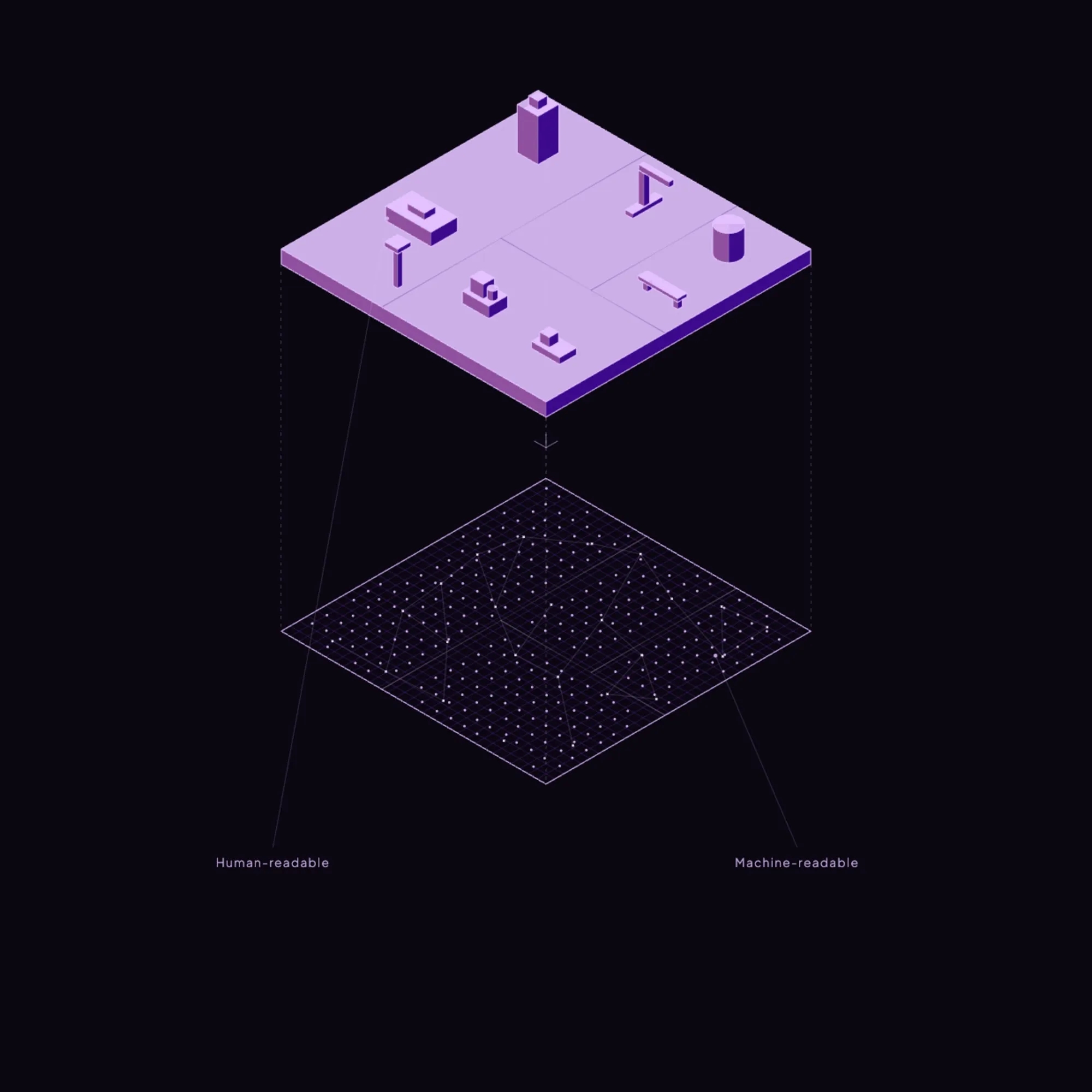
Every MultiSet map is readable two ways at once: a photoreal view your team can see and review, and a machine-readable map your devices, robots, and agents localize against in real time. Capture once. Serve people and machines from the same source of truth.

Diagram of 3D mapping devices: 360 camera, Phone LiDAR, Mobile SLAM, drone, and terrestrial survey sensors.Two-layered purple schematic showing human-readable objects above machine-readable data points.
Scan-Agnostic Mapping

Use LiDAR, E57, 3DGS, 360 Videos, 3D Tiles & More

Your scan. Your cloud. Your rules.

MultiSet runs the same everywhere. Your capture vendor stays your choice. Your data never becomes someone else's model. That's what makes MultiSet a neutral layer instead of another walled garden.

Dedicated cloudPrivate VPCOn-DeviceAir-gapped
MultiSet iOS Mapper

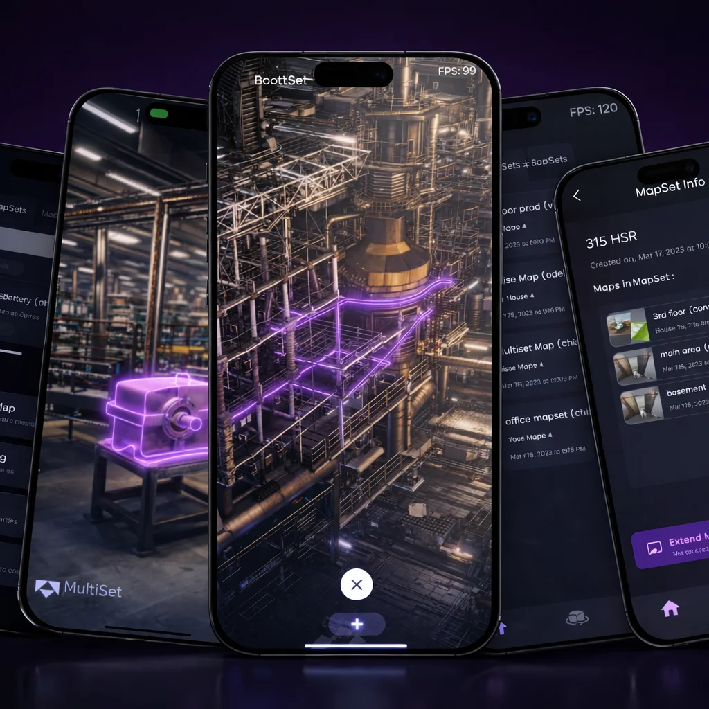
Turn any LiDAR-enabled iPhone or iPad into a complete VPS prototyping kit. Scan a space to build a VPS map in minutes, author and share AR experiences instantly with Content Spaces, capture simulation data, and validate localization and object tracking success on the spot. The fastest way to test MultiSet before you build.

Four smartphones displaying a 3D industrial facility model with interconnected pipes highlighted in purple and dark-themed app interfaces with tools and maps.
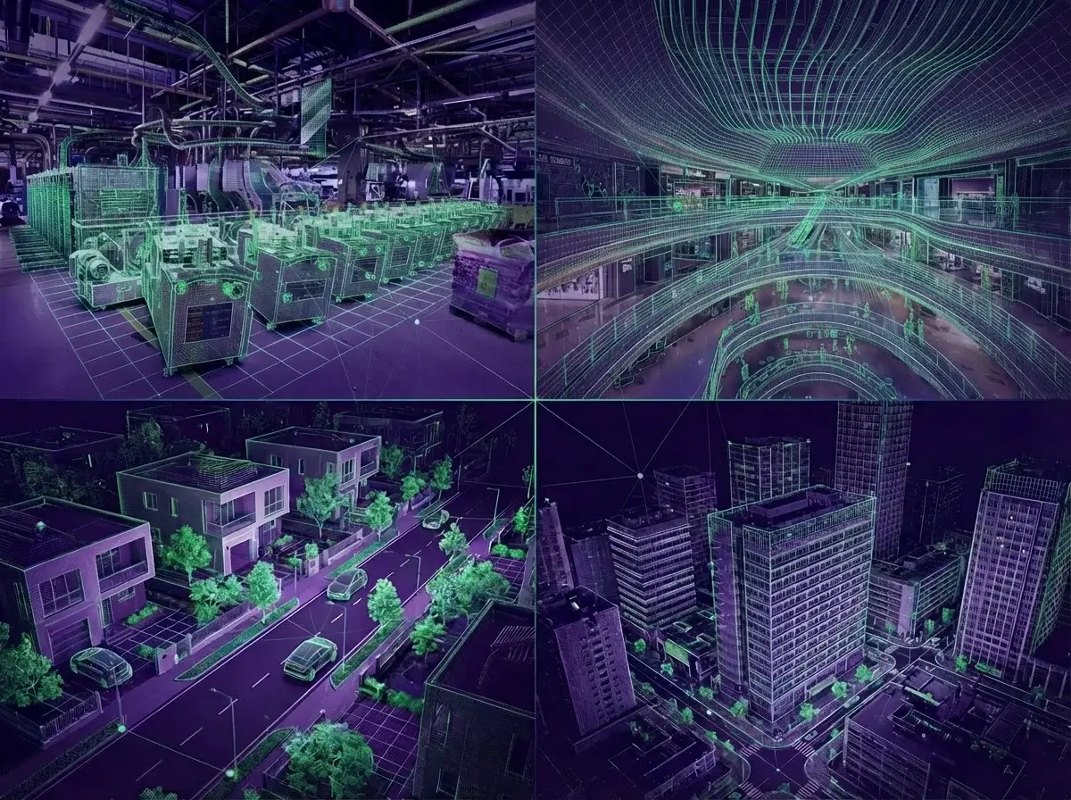
Composite image showing digital wireframe overlays on photos of an industrial facility, shopping mall interior, suburban neighborhood, and urban cityscape.
No size limit. If a camera can see it, MultiSet can map it.
MapSet stitches every scan across floors, buildings, indoors and out into one coordinate system, so a map grows as large as you keep capturing and navigation never breaks at a doorway. Change one area without remapping the rest.

Combine & merge multiple scanners and file formats to build limitless maps.
MapSets

Supported scanners and file formats

MultiSet ingests reality capture from every major scanner and format:

ProviderDevicesCapture typeFormats ingested
AppleiPhone Pro, iPad Pro (MultiSet app)LiDARNative LiDAR
MatterportPro2, Pro3Laser + photoE57, MatterPak
Leica GeosystemsRTC360, BLK360, BLK2GOTerrestrial & mobile LiDARE57
NavVisVLX 2, VLX 3, MLXMobile mapping (SLAM)E57
FAROFocus, Focus PremiumTerrestrial LiDARE57
XGRIDSPortalCam, Lixel K1, K2, L2 ProMobile LiDAR + Gaussian splatE57, Gaussian splat
Insta360X4, X5360° video360 video
AntigravityA1 (360° drone)Aerial 360° video360 video
PolycamiOS / Android appPhone scanGLB, PLY (textured mesh)
Any E57-compatible scanner-Terrestrial / mobile LiDARE57
Any metric-scaled 3DGS tool-Gaussian splatGaussian splat
Public / third-party 3D-Existing 3D map data3D Tiles

Per-scanner guides: Matterport, NavVis, Leica, FARO and XGRIDS. For aerial capture, see drone to VPS.

Inputs and outputs

How to convert reality capture data into a machine readable localization map

One capture produces two different things. A machine-readable map, the feature representation a camera localizes against, and human-readable artifacts, the mesh, splat, panorama tour and point cloud people look at. Most of the market produces one or the other.

On how the human-readable artifact is produced and where it differs from a survey deliverable, see Gaussian splatting versus photogrammetry. Terms used here are defined in the glossary.

For what a processed map hands back, in which formats and in which coordinate frame, see map outputs.

InputSource hardware or toolProducesNotes
E57Matterport, Leica, NavVis, Faro, XGRIDSVPS map, point cloudThe industry interchange format. Most existing scans are already here
MatterPakMatterportVPS map, meshThe bundle Matterport exports for downstream use
GLB / PLYPolycam, Scaniverse, CADVPS map, meshTextured meshes
Gaussian splat (.ply / .spz)Any 3DGS pipelineVPS map, splatMust be metric-scaled. A scale-free splat is a picture, not a map
360 videoInsta360 and similar, raw or equirectangular MP4VPS map, panorama tourOne walkthrough, or one flight
Native LiDARiPhone and iPad Pro, via MultiSet MapperVPS map, meshNo professional hardware required
Frequently asked questions
What's the difference between a digital twin and a VPS?

A digital twin shows you a space. A visual positioning system (VPS) tells a device where it is inside that space, in real time. MultiSet is the VPS layer that makes a twin operational for cameras, robots, and agents.

What reality-capture formats does MultiSet support?

E57 from Matterport, Leica, NavVis, XGRIDS and FARO; Matterport MatterPak; textured meshes; raw LiDAR; 360 video; metric-scaled Gaussian splats; and 3D tiles, including public and third-party sources.

What makes MultiSet scan-agnostic?

We accept the widest range of formats and normalize them into one coordinate system - so you're never locked to a single scanner or vendor. New map versions and new MapSet sections can use different hardware and formats.

Can I localize a camera or robot against 3D data I already own - point cloud, mesh, BIM, digital twin, splat, or GIS?

Yes - in real time, with no re-scan.

Do I have to capture anything myself?

No. Use a scanner you own, capture with a phone, have our partners capture for you, or localize against public and third-party 3D data that already exists - 3D tiles and open geospatial sources.

How do I make my reality capture data actionable?

Feed the scans you already own into MultiSet. It turns them into a live map devices localize and track against - so the capture drives action, not just viewing.

Can I export maps to other spatial tools?

Yes. Maps and MapSets export as GLB, USDZ or OBJ meshes, PLY or SPZ splats and a PCD point cloud, letting you reuse geometry in BIM, game engines or digital-twin analytics platforms - no vendor lock-in.

How does MapSet enable large‐scale coverage?

MapSet stitches many smaller scans into one seamless “mega-map.” It preserves the detail of each fragment while providing a single coordinate system, so users experience uninterrupted navigation across rooms, floors and outdoor areas.