A photoreal 3D reconstruction of a facility viewed on a tablet

Gaussian Splatting vs Photogrammetry vs NeRF: Which One Can a Machine Use?

Three ways to reconstruct a space from images, and one property that decides them.

Metric scale is the difference between a picture and a map.

A reconstruction can look photoreal and still be useless for positioning. What matters is whether one unit in the model equals one real metre.

The Property That Decides It

Photogrammetry, Gaussian splatting and NeRF all turn photographs into a 3D reconstruction. They differ in how they represent the scene and in how fast they render, and most comparisons stop there. For anything a machine has to act on, the question is metric scale: does one unit in the reconstruction equal one metre in the building?

Without it you have a shape that is correct in proportion and unknown in size. You can look at it, and you cannot measure against it, place an anchor in it, or ask a robot where it is inside it. A model that is not metric is a picture of a place.

Why splats are not scaled by default
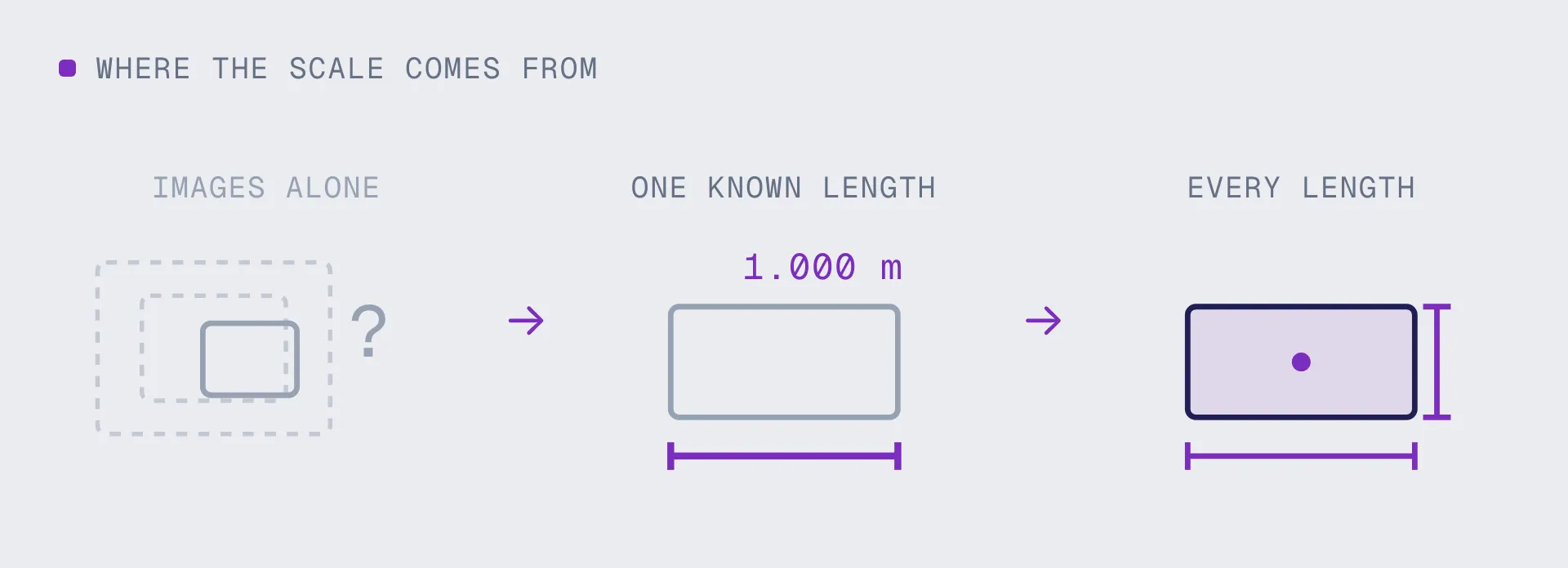
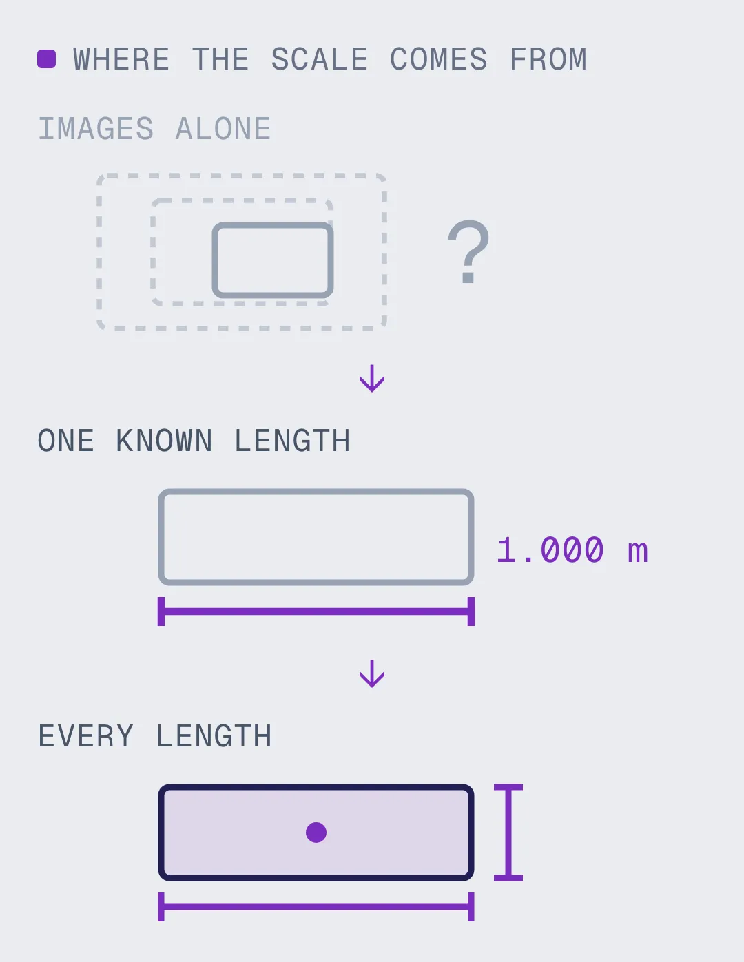
Gaussian splatting reconstructs from images alone, and images carry no absolute size. The solver recovers the scene up to an unknown scale factor, which is invisible when you are looking at it and fatal when you are localizing against it. Pose error scales directly with that factor, so a splat that is 4 percent small puts a device 4 cm out at one metre and 40 cm out at ten. Photogrammetry hits the same problem and solves it routinely, because survey workflows have included scale bars and control points for decades.

Scale from images alone: unknown, unless something fixes it
What fixes it:

- A LiDAR or depth channel captured alongside the images
- Scale bars, surveyed control points, or a known camera baseline

How To Tell If Yours Is Usable

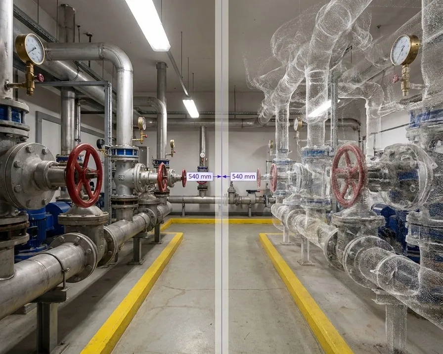
Measuring a known dimension to test whether a reconstruction is metrically scaled
Measure something you know
Find a doorway, a pallet, a standard rack bay, anything whose real dimension you can check. Measure it in the reconstruction. If it comes back in arbitrary units, or in metres that are wrong by a consistent percentage, the model is not metric and no amount of visual quality changes that.
Checking viewpoint coverage in a Gaussian splat rather than render quality
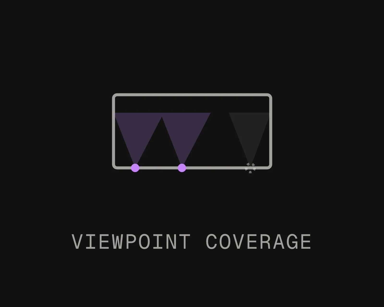
Check the coverage, not the render
A splat can look flawless from the path the camera walked and hold almost nothing from a viewpoint nobody composed. Localization happens from wherever a person or robot happens to stand, so overlap between consecutive viewpoints matters more than the beauty of the preview.
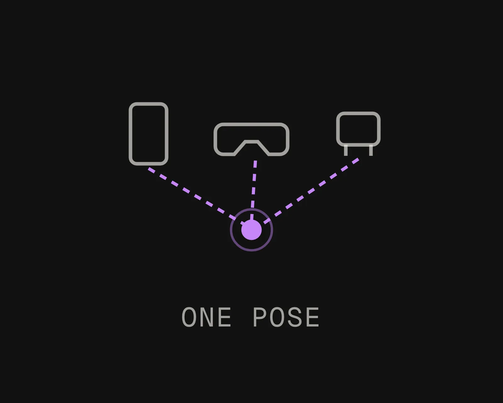
A Gaussian splat converted into a localization map devices query for 6-DoF pose
Turn it into a map
MultiSet ingests 3D Gaussian splats and photogrammetry output alike, resolves scale, and produces a localization map devices query for 6-DoF pose. The splat stays the thing people look at. The map is the thing machines use, and both come from the same capture.

What Each Method Is Good At

Photogrammetry

Reconstructs geometry from overlapping photographs, and outputs a mesh or point cloud you can measure against. Slow to process, mature, and well understood. Because it grew out of survey practice, scale is routinely resolved with control points, which is why its output is usually usable as-is.
Gaussian Splatting

Represents the scene as many small oriented blobs rather than surfaces. Photoreal, fast to render in real time, and forgiving of reflective and transparent surfaces that defeat mesh reconstruction. Not metric by default, and there is no surface to measure against without further work.
NeRF

The neural radiance field approach that came before splatting. Strong on view synthesis and generally too slow to render in real time, which is why splatting has largely replaced it for practical work. The scale problem is identical.
None Of Them Is A Localization Map

All three produce something for a person to look at. A localization map is a different artifact: it is what a device queries to work out where it is, and it has to be metric, coverage-complete and queryable in milliseconds. You derive one from the other; they are not the same file.
One Capture, Two Outputs

The expensive part of any of this is the site visit. A single pass should produce both the human-readable reconstruction and the machine-readable map, rather than sending someone back with different equipment to capture the same building twice.
Mix Them In One Coordinate System

A splat of the showroom, a laser scan of the plant room and a phone capture of the corridor between them can stitch into one continuous frame. The method used per area matters less than everything resolving into the same coordinates.

The Three Compared On What Matters

Photogrammetry and splatting are the live choice for most teams. NeRF is included because it still comes up, and because the scale question applies equally.
Send Us A Capture
DIMENSION
Photogrammetry
Gaussian splatting
How the scene is represented
Mesh or point cloud, with real surfaces
Many small oriented blobs, no surface
Metric scale out of the box
Usually, because control points are standard practice
No. Needs depth, control points or a known baseline
Visual quality
Good, and weak on reflective or transparent surfaces
Photoreal, and handles glass and gloss well
Can you measure against it
Yes. That is what it was built for
Not directly. There is no surface to measure to
Render speed
Depends on mesh size. Heavy at full detail
Real time, which is why it took over for viewing
Use it as a localization input
Yes, once registered into one coordinate system
Yes, once scale is resolved. MultiSet ingests 3DGS directly
Frequently asked questions
What is the difference between Gaussian splatting and photogrammetry?

Photogrammetry reconstructs actual surfaces, a mesh or point cloud you can measure against, and is usually metrically scaled because survey workflows include control points. Gaussian splatting represents the scene as many small oriented blobs, renders in real time, and looks better, but has no surface to measure and is not scaled by default. One is built for measurement, the other for viewing.

Is Gaussian splatting metrically accurate?

Not on its own. Reconstruction from images alone recovers the scene up to an unknown scale factor, because photographs carry no absolute size. The geometry can be proportionally correct and still be the wrong size. Scale has to come from somewhere else: a depth or LiDAR channel captured alongside, scale bars, surveyed control points, or a known camera baseline.

Can you use a Gaussian splat for localization?

Yes, once scale is resolved and coverage is good enough. MultiSet ingests 3D Gaussian splats as a native input and produces a localization map from them, which devices query for 6-DoF pose at sub-5 cm median accuracy. What you cannot do is point a device at an unscaled splat and expect a trustworthy position, because pose error scales directly with the scale error.

Is NeRF still worth using?

For most practical work, splatting has replaced it. NeRF produces excellent view synthesis but is generally too slow to render in real time, and it carries the same unknown-scale problem. If you already have NeRF output, the useful question is the same one: what fixed the scale?

How do I check whether my reconstruction is metric?

Measure something whose real size you know: a doorway, a pallet, a standard rack bay. If the reconstruction returns arbitrary units, or metres that are consistently off by a percentage, it is not metric. Do this before judging a reconstruction by how it looks, because visual quality tells you nothing about scale.

Which should I use for a digital twin?

If people will measure and document against it, photogrammetry or laser scanning, because you need real surfaces. If people will mostly look at it and walk through it, splatting looks considerably better. If devices need to localize in it, that is a separate artifact derived from either, and it should come from the same capture rather than a second site visit.

Can splats and laser scans be combined in one map?

Yes. A splat of one area, an E57 laser scan of another and a phone capture of the corridor between them stitch into a single continuous coordinate system. Devices localize across all of it without knowing which method produced which section.