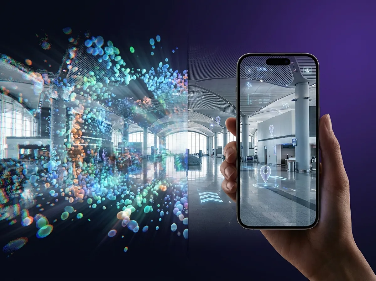
Digital visualization showing spatial computing for industrial space mapping with raw point cloud data transforming into interactive AR interface on a tablet.

Gaussian Splats to VPS: Photorealistic Scans Meet Centimeter-Accurate Localization & Tracking

3D Gaussian Splatting is becoming the JPEG of 3D.

Upload a metric-scaled .ply file with camera poses and get a production-ready spatial map. Sub-5 cm median localization accuracy.

Deploy on your cloud, your VPC, or fully on-device.

No vendor lock-in. No compromises on visual fidelity.

Capture It. Splat It. Localize It.

MultiSet accepts metric-scaled 3D Gaussian Splats as a native VPS input.

Upload a .ply splat file alongside a poses.json with camera trajectories. The platform generates an XR-ready map while preserving the photorealistic fidelity that makes Gaussian Splatting revolutionary.

XGRIDS company logo featuring stylized blue text and a geometric icon.
3D model of a purple and white molecular structure with interconnected spheres and rods on a dark background.
Any Compatible Pipeline
Diagram showing a purple checkmark connected by a line to a loading spinner, which is then connected to a dashed square with an X.
More Native Pipelines Coming Soon
Supported devices: PortalCam, L2 Pro, K1, K2 (or any device capturing via Lixel CyberColor)

Processing software:
Lixel CyberColor

XGRIDS Gaussian Splat Export
MultiSet is hardware-agnostic. If your pipeline produces the right output, it works.

Output: A single .zip containing your .ply (Gaussian Splat) and poses.json (with ts, T, R, and optionally RGB fields per pose).

Requirement: The .ply must be strictly metric-scaled (1 unit = 1 meter).
Ecosystem focus: Emerging 3DGS tools and photogrammetry pipelines that ship with metric-scale output by default.

From Gaussian Splat to AR in Three Steps

Reconstruct
Capture your environment with a supported device. Reconstruct it as a 3D Gaussian Splat. Enable Portability (metric scale) and locate your .ply and poses.json in the output directory.
Upload
Bundle the .ply splat file and poses.json into a single .zip. Upload on MultiSet portal by selecting "Gaussian Splat" as the input type. Choose indoor or outdoor. Drag and drop your zip. Processing begins immediately.
Localize & Build
Your VPS map is live. Query it via REST API, Unity SDK, native iOS/Android, WebXR, or Meta Quest. Pin XR content with sub-5 cm median accuracy. Scale across floors with MapSet.

Why Gaussian Splats Belong in Your XR Stack

Enterprise-Grade 3DGS Ingest

MultiSet accepts 3D Gaussian Splats as a native VPS input and pairs it with the deployment flexibility enterprises need. Public cloud. Private VPC. Self-hosted on-prem. Fully on-device. Your data, your infrastructure.
Photorealistic Fidelity, Production-Grade Accuracy

Gaussian Splatting captures scene appearance with unmatched visual quality. MultiSet converts that fidelity into sub-5 cm median localization accuracy with poses in 1.5 to 2.5 s from the cloud or about 52 ms on-device. Beautiful scans. Precise AR.
Future-Proof Format

3DGS is on track to become the universal 3D capture standard. The Khronos KHR_gaussian_splatting glTF extension is targeting ratification in Q2 2026. The open-source SPZ compression format is already adopted across the ecosystem. Build on the format the industry is converging on.
Metric Scale = Real-World Accuracy

MultiSet requires metric-scaled reconstructions. Every AR anchor, navigation path, and spatial query maps precisely to the real world. Portability mode in Lixel CyberColor guarantees this.
Cross-Platform SDKs

Build once with Unity, iOS, Android, WebXR, Meta Quest, or ROS 2. Launch browser-based AR from a QR code with zero app installs via WebXR Kit and App Clips. Your splat-derived maps work everywhere.
Campus-Scale with MapSet

Stitch Gaussian Splat maps from multiple floors and buildings into seamless MapSets. Users localize continuously as they move between spaces. No manual transitions. No drift. Mix splat maps with E57 maps in the same deployment.

3D Gaussian Splatting vs. Traditional AR Mapping

A universal, efficient representation that captures real-world scenes with photorealistic quality. Here's how 3DGS-based VPS compares.
Pilot Project
CAPABILITY
Traditional Approach
MultiSet 3DGS Ingest
Visual quality
Feature points or sparse mesh
Photorealistic Gaussian Splats
Capture hardware
Phone/tablet only or LiDAR scanner
Any device with camera
Scene representation
Point clouds or triangulated mesh
Millions of 3D Gaussians with color, opacity, scale
Rendering speed
Varies; often requires baked assets
Real-time splatting at 60+ FPS
Metric accuracy
Depends on capture method
Guaranteed via Portability mode (metric scale)
Industry trajectory
Established but plateauing
Rapidly standardizing (Khronos glTF extension)
How the formats differ

Gaussian splatting compared to photogrammetry, NeRF and point clouds

These four are often discussed as competing ways to reconstruct a space. They are better understood as four different things to store, each good at a different job. Only two of them are usable as a localization map without further work.

Gaussian splattingPhotogrammetry meshNeRFPoint cloud
What it storesOriented gaussians with colourTriangles and textureA learned radiance fieldDiscrete measured points
Renders in real timeYesYesUsually notAs points
Metric scale by defaultNoUsuallyNoYes
EditableHardYesNoYes
Usable for localizationOnly if metric-scaledYesRarelyYes
Best atPhotoreal viewing at speedGeometry you can measure and editResearch-grade view synthesisSurvey and as-built accuracy

Metric scale is the whole point

This is the row that decides whether a Gaussian splat is useful to a machine, and it is the one most easily missed, because it is invisible in the thing you are looking at.

A splat reconstructed from images alone is internally consistent but scale-free. The geometry is right in proportion and wrong in absolute terms: the room might come out at 0.8 or 1.3 times its true size and the render looks perfect either way. For viewing, that does not matter at all. For localization it is fatal, because a pose returned in the wrong scale puts a label in the wrong place by an amount that grows with distance.

A map that is not metric is not a map. It is a picture of a place.

Metric scale comes from something in the capture that knows real distance: LiDAR depth, a calibrated stereo rig, a scanner's own measurements, or control points surveyed in the space. If a splat was produced by a pipeline that had access to one of those, it carries scale. If it came from phone video and nothing else, it usually does not.

The practical test is to measure something you know in the splat, a door height or a pallet width, and see whether it comes back correct. MultiSet ingests metric-scaled splats directly. For one that has lost its scale, the fix is to recover it from a reference measurement or from the source capture rather than to re-shoot the space.

One capture, two artifacts

This is the scan-agnostic argument in its clearest form, and Gaussian splatting is where it shows best.

The same capture produces a splat a human can look at, walk through and show a client, and a feature map a machine localizes against to a few centimetres. One is human-readable, the other machine-readable, and they come from one pass through the building rather than two.

Most of the market produces one or the other. Visualization tools give a beautiful reconstruction that no device can position itself against. Localization vendors give a map that works and that nobody wants to look at. Producing both from a single capture is what removes the second site visit, and on a live plant or a secure facility that second visit is the expensive part.


Frequently asked questions
What is a metric-scaled Gaussian Splat?

A metric-scaled Gaussian Splat is a 3D reconstruction where 1 unit = 1 real-world meter. This is required for VPS accuracy. In Lixel CyberColor, enable Portability before reconstruction to ensure metric scale output.

Why does Portability need to be ON in Lixel CyberColor?

Portability mode produces a metric-scaled reconstruction. Without it, the Gaussian Splat uses an arbitrary coordinate system that does not map to real-world distances. MultiSet requires metric scale for accurate localization.

What file format does MultiSet accept for Gaussian Splats?

A single .zip containing two files: a metric-scaled .ply (Gaussian Splat) and a poses.json with camera trajectories. The poses.json includes ts (timestamp), T (translation), R (rotation), and optionally RGB fields per camera pose.

Can I combine Gaussian Splat maps with E57 maps?

Yes. MapSet lets you stitch maps from different input formats into a single deployment. You can mix Gaussian Splat maps and E57 maps across floors and buildings. Users localize across all stitched maps without manual transitions.

Does 3DGS ingest work for outdoor environments?

Yes. During upload, select "Outdoor" as the environment type. MultiSet's VPS is robust to dynamic lighting, weather changes, and moving objects in outdoor scenes.

Will more capture pipelines be supported beyond XGRIDS?

Yes. Gaussian Splatting tooling is evolving rapidly. As more capture tools ship metric-scale output, MultiSet will validate and add support. Contact us if you have a specific pipeline you need supported.