VPS

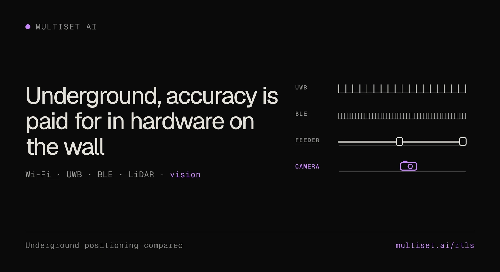
Underground, every positioning system hangs off something on the wall. Access points, radiating cable, UWB anchors and RFID readers all have to be powered, connected and carried forward each time the face advances (MST, Rajant).
So accuracy comes down to how much hardware a mine will install and move. Here's how the options compare, and where a camera on the mine's own 3D scan fits.
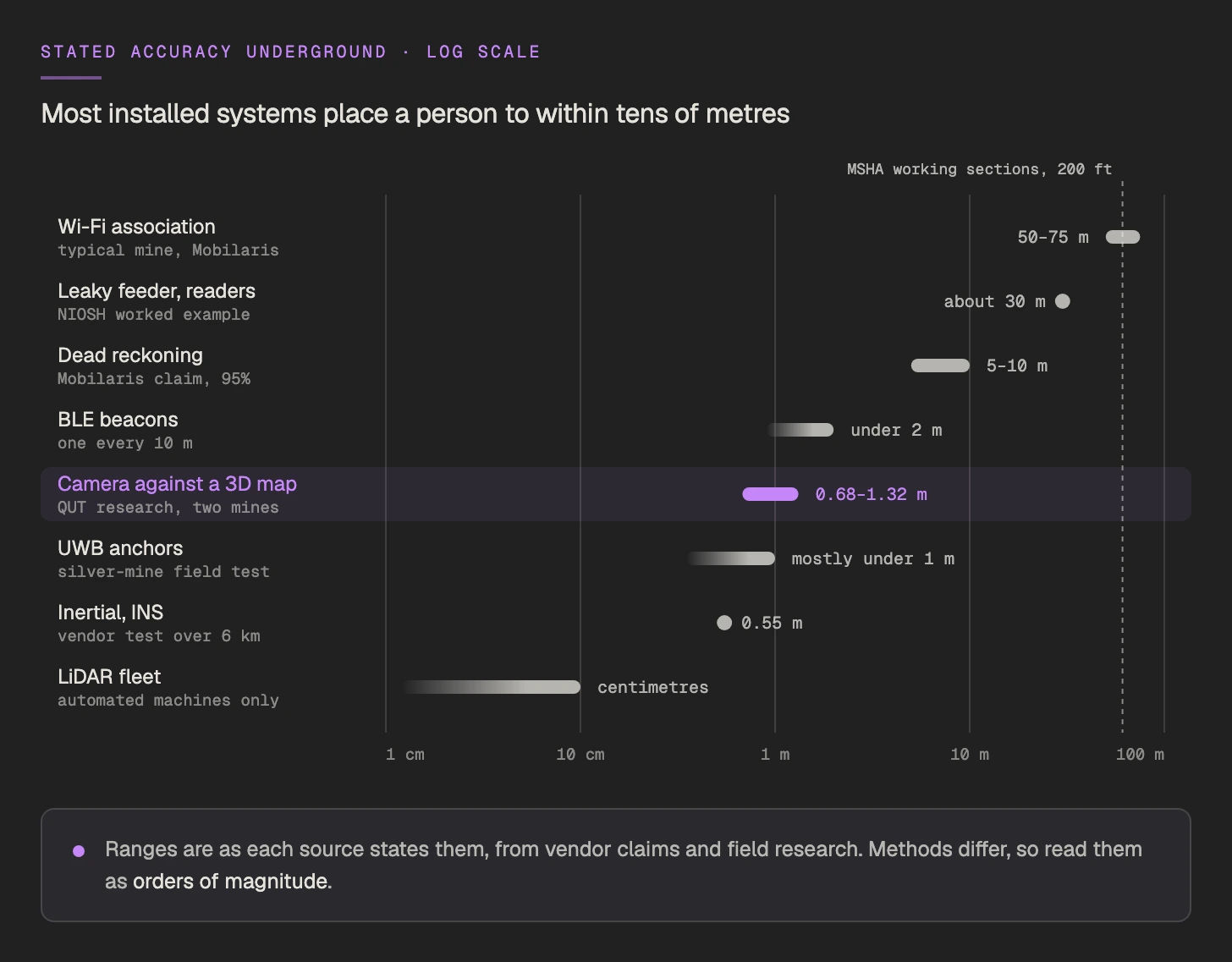
Quick answer. Most underground mines track people and vehicles with Wi-Fi, leaky feeder or RFID zones, which place them to within tens of metres. UWB anchors and BLE beacons reach a metre or two where they're installed every 10 to 40 m. LiDAR steers automated machines on their own maps, and dead reckoning needs no infrastructure but drifts. A camera localizing against the mine's 3D scan needs nothing on the wall.
| System | Stated accuracy | What goes on the wall |
|---|---|---|
| Wi-Fi association | 50 to 75 m typical, under 10 m in trials | Access points on fibre and power |
| Leaky feeder with readers | About 30 m, in the cabled entry only | Radiating cable, amplifiers every 450 to 550 m |
| RFID zones | Half the reader spacing | Powered readers |
| UWB anchors | Mostly under 1 m | An anchor every 15 to 40 m |
| BLE beacons | Under 2 m | A beacon every 10 m |
| LiDAR fleet navigation | Centimetres, on the machine's own map | Lidar on each automated machine |
| Dead reckoning | 5 to 10 m, and drifts | A tablet on the CAN bus |
| Camera against a 3D map | About 1.2 m vision-only in research | A camera on the vehicle, plus the scan |
Rules set the minimum. Sweden has required continuously updated headcount and location underground since 1 January 2025 (AFS 2023:13), and MSHA expects US coal operators to locate miners within 200 ft on working sections (MSHA). Above that, the job decides. In 2019 Mobilaris argued that 50 to 100 m covers many hard-rock uses, and that traffic management needs 5 to 10 m (Epiroc).
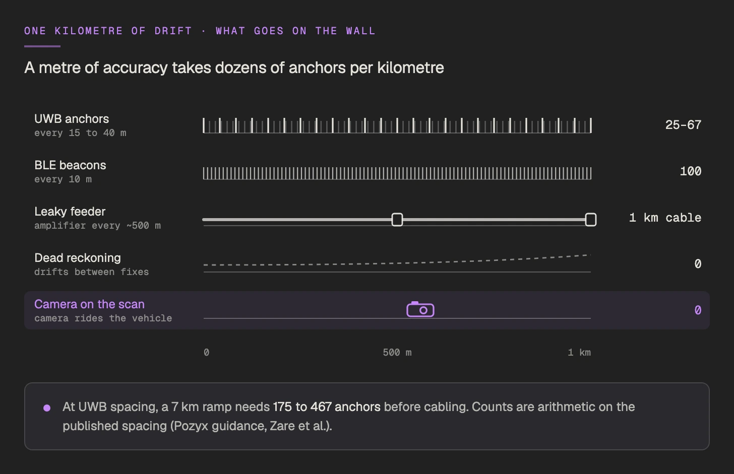
Wi-Fi rides the network most mines already run, at 50 to 75 m on tags (Mining Magazine). Trials reach under 10 m with more access points than data alone needs (Zare et al., Epiroc).
Leaky feeder tracks only the entry its cable runs in, about 30 m in NIOSH's example. RFID zones are as precise as half the reader spacing (NIOSH).
UWB gets under a metre when the anchors can see each other (Ziegler et al.). At 15 to 40 m spacing (Pozyx), a 7 km ramp needs 175 to 467 anchors before any cabling.
BLE came in under 2 m with a beacon every 10 m in a corridor (Zare et al.), and each beacon runs on a battery.
LiDAR fleets steer automated loaders and trucks at centimetre precision, mostly one level at a time (Sandvik). People and light vehicles need something else.
Dead reckoning needs nothing installed. Mobilaris claims 5 to 10 m 95% of the time (Mining Magazine), and the trail drifts until something corrects it (NIOSH).
Research says yes. QUT's LookUP, built with Caterpillar, averaged about 1.2 m from a camera alone at two mine sites (arXiv). Fused with LiDAR, mean error came to 0.68 m and 1.32 m in two operating hard-rock mines (Journal of Field Robotics). The same work names what makes it hard, from scarce light and motion blur to repetitive walls, dust and water (ACRA 2018).
Above ground, camera RTLS already runs on forklifts and from ceilings, with each system keeping its own map (vision-based RTLS).
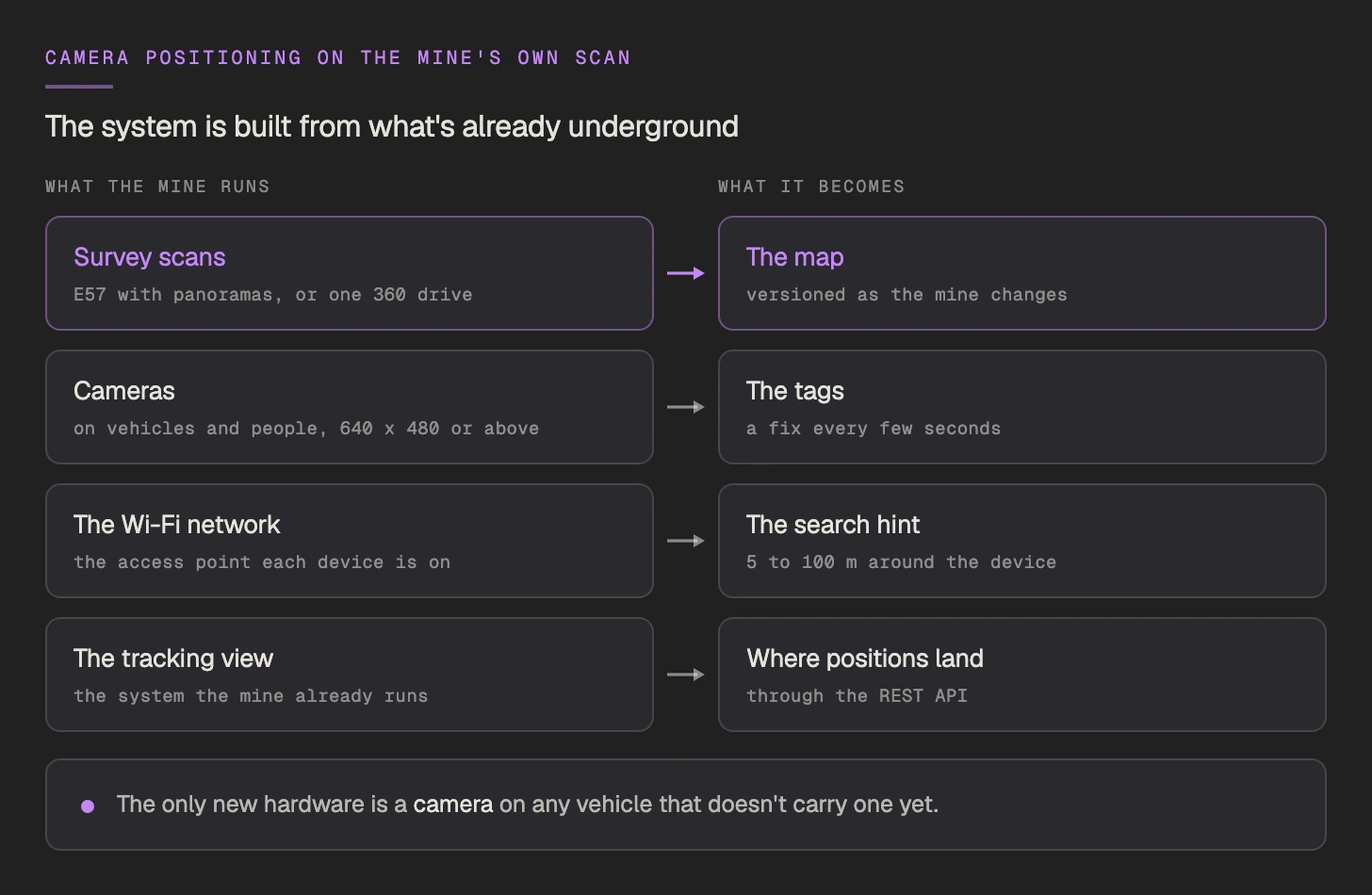
MultiSet's visual positioning system builds the positioning system from what the mine already runs.
Survey scans become the map. An E57 export with its panoramas converts with no re-capture (E57 to VPS), and a point cloud without imagery needs one drive with a 360 camera (360 to VPS). Where survey already scans after each round, as at Olympic Dam (AusIMM Bulletin), those scans become new map versions.
Any camera at 640 x 480 or above becomes the tag, and gets its position and orientation on the scan every few seconds.
Your Wi-Fi network becomes the hint. A query can carry an approximate position with a 5 to 100 m radius plus the level (Map Query API), which narrows the search to one stretch of drift.
Positions land in the mine's own tracking view through a REST API, and a dead-reckoning system can take each fix as its correction.
The same fix covers two jobs. Locate puts every camera-carrying person, vehicle and drone on the scan for a management view and traffic analysis. Guide takes a technician to the asset and shows the work order on it. Drones already fly indoors on this kind of fix, where GPS drops out (GPS-denied navigation).
Light. Capture the map under the lighting the vehicles run, since low and high beam light two different scenes.
Lenses. A fouled lens returns no fix, so mount cameras where wipers or a cleaning routine reach them.
Shotcrete. A sprayed wall looks new while its geometry barely moves, and the next survey scan brings the map up to date.
New headings. A heading nobody has scanned has nothing to match yet. Growing the map past the face from the vehicles' own images is the next step.
People. Cameras worn by workers can need union consultation in Sweden (IMY), which makes vehicles the easier start.
Above ground, concentrators and smelters are lit and built like the process plants where this already runs (case studies).
Most mines use their Wi-Fi network, leaky feeder with tag readers, or RFID zones, which place a miner to within tens of metres. UWB anchors and BLE beacons add metre-level accuracy where they're installed. Sweden, the EU, the US and South Africa all set rules for knowing who is underground.
A Mobilaris executive put Wi-Fi tag accuracy at 50 to 75 m in a typical mine. Trials have reached under 10 m with denser access points.
It does where the anchors have line of sight. A field test in a German silver mine measured errors mostly under 1 m. The cost is density, at 25 to 67 anchors per kilometre of drift at typical spacing.
Research says yes. QUT's camera-only system averaged about 1.2 m at two mine sites. MultiSet localizes cameras against the mine's own 3D scan, so the hardware is a camera and a scan the mine already holds.
Since 1 January 2025, AFS 2023:13 requires headcount and location underground to be available and continuously updated, so people in distress can be found.