Press Release

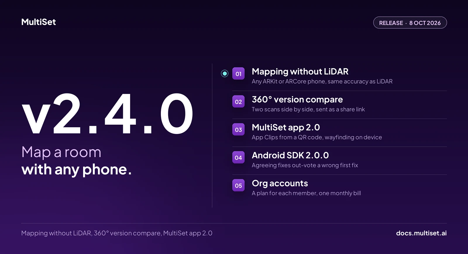
MultiSet AI has released v2.4.0. Building a map with a phone used to take a LiDAR sensor, and that meant an iPhone Pro or an iPad Pro. From v2.4.0, every ARKit iPhone and iPad and every ARCore Android device can build one in the MultiSet app, with the same localization accuracy as a LiDAR capture. The release also puts two scans of a space side by side in 360° behind a share link, and it processes E57 scans faster. It lands alongside version 2.0 of the MultiSet app and version 2.0.0 of the Android SDK. Org accounts now give each team member their own plan.
v2.4.0 shipped on 8 October 2026.
Until this release, any ARKit or ARCore phone could localize against a MultiSet map, but only a phone with LiDAR could build one. That ruled out every Android phone and most iPhones.
v2.4.0 builds the map from the camera and the phone's own tracking. Open the MultiSet app on any ARKit iPhone or iPad or any ARCore Android device, walk the space, and upload. The map localizes as accurately as one captured with LiDAR, and it comes back with a textured mesh, a raw mesh, a USDZ export and a point cloud, the same as every other map.
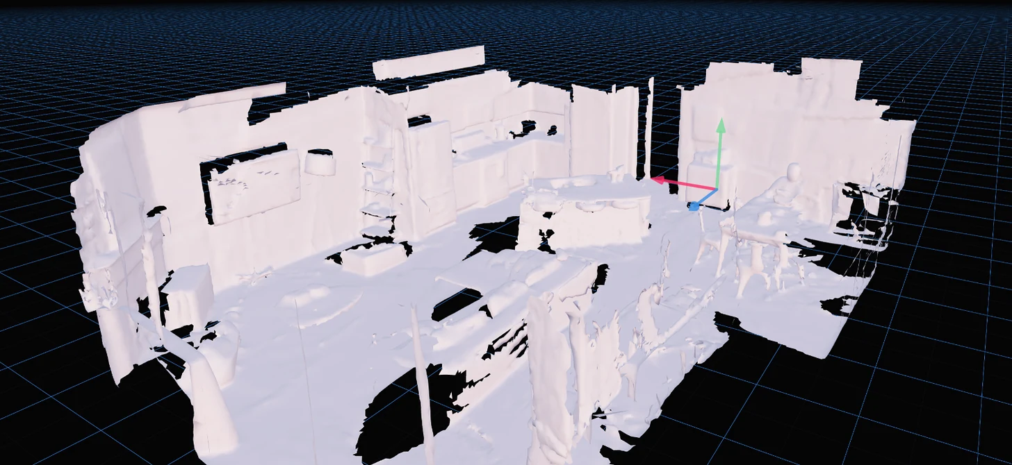
Phone mapping without LiDAR is built for prototyping small areas, up to about 5,000 sq ft: a room, a lab, a store or a demo space. Larger sites still come from a laser scanner or a 360 camera, carried on foot or flown on a drone.
For teams building capture into their own app, the same capability is a new upload type. Package the camera frames, each with its pose, plus the camera intrinsics as a PosedRGB capture, with no depth images and no mesh, and upload it with the same three calls as any other map. Frames go in at about five per second, each overlapping two or three of its neighbours.
Nothing in that package is specific to a phone. A robot or a drone that tracks its own camera pose can build a map the same way, from its own camera, and then localize against it.

A phone map can also be the first version of a site. When a LiDAR or laser scan arrives later, add it as a Map Version, and the content authored against the phone map stays where it was put.
Map Versioning has kept content anchored across re-scans since v1.14.0. Showing someone what changed between two scans still took a portal login or a screen share.
v2.4.0 adds Version compare. Open a versioned map in the Developer Portal and select Compare 360°, and the two scans sit side by side as 360° panoramas, matched viewpoint by viewpoint. The second pane shows how far its viewpoint sits from the first, in metres and degrees, and a minimap and a list of nearby viewpoints carry the walk.
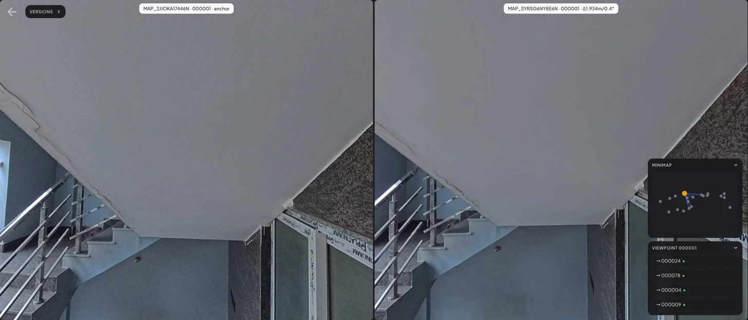
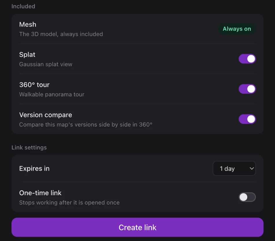
The same view goes out as a share link. In the share dialog, turn on Version compare, choose how long the link lives, and send it. The recipient opens it in a browser with no account and nothing to install. Links last 1 day, 7 days, 30 days or with no end date, can be one-time, and stop working for everyone the moment they are revoked. Version compare needs two versions that each have a 360° tour.
Use it to show an owner how far a build has come, or to walk a facility manager through what changed after a re-scan.
E57 scans process faster in v2.4.0, and MatterPak and E57 uploads get processing fixes. Upload the same files the same way.
Version 2.0 of the MultiSet app shipped on iOS in September. It covers the field work around a map, from the first scan to the experience a visitor opens.
Pin 3D text and images to a mapped space and mark the points people should be guided to. Then publish. Visitors scan a QR code and the experience opens as an App Clip, without an install or an account. Turn-by-turn wayfinding to those points is computed on the phone.
On site, the app localizes against any map and draws the mesh over the room, so a misalignment shows at a glance. Each result carries its confidence and response time alongside the pose. Control points captured in the app tie a map to real-world coordinates. Scans upload in the background and save as drafts when the signal drops, which matters in basements and plant rooms.
A visually similar spot can produce a confident localization in the wrong place. Android SDK 2.0.0, released on 7 October, turns its false-positive gate on by default and changes how the gate decides.
The first fix becomes an anchor, and later fixes that agree with it refine it. A fix that disagrees by more than 4 m or 25° of heading, both adjustable, has to win a vote counted in distinct viewpoints, meaning camera positions 1.5 m apart or headings 20° apart. A trusted anchor takes three such viewpoints to move, and ties go to the anchor. Repeating a query without moving adds nothing.
When agreeing fixes do move the anchor, onLocalizationCorrected reports it so the app can re-parent its content, and onAnchorTrustChanged reports how well supported the anchor is. Two rejections in a row trigger one multi-frame request to settle the question. For repetitive spaces, mapAliasingRisk raises the bar map by map.
The SDK needs only a camera image with its pose and intrinsics, so it runs on ARCore or on any other Android XR runtime. Upgrading from 1.16.0 is source-breaking, and the upgrade notes list each change.
An org account adds team members and gives each one their own Free, Lite or Plus plan, with one monthly bill for the plans it activates. Developers can sit on Plus and reviewers on Free inside the same organisation, and nobody pays for seats they don't use.
Members join by email invitation and hold a role, Admin or Viewer, set by the account owner.
v2.4.0 is live on MultiSet's public cloud and rolling out to private-cloud, self-hosted and on-device customers on each environment's normal cadence.
Mapping without LiDAR is in the MultiSet app on iOS and Android today, so update the app to use it. PosedRGB is a new fileType value, and existing uploads are unchanged. Version compare is in the Developer Portal and the share dialog for any versioned map whose versions have 360° tours. Android apps moving to SDK 2.0.0 should read the upgrade notes first, because the false-positive gate now defaults on.
Full details in the v2.4.0 changelog.
Yes. Since v2.4.0, the MultiSet app builds maps on any ARKit iPhone or iPad and any ARCore Android device, with the same localization accuracy as a LiDAR capture. It is built for prototyping small areas, up to about 5,000 sq ft, and each map comes with a mesh and a point cloud.
Phones and tablets in the MultiSet app, with or without LiDAR. Through the API, any device that tracks its own camera pose, a robot or a drone for example, can upload a PosedRGB capture. Larger sites come from E57 laser scans, MatterPak, 360 video and metric-scaled Gaussian Splats.
Add the newer scan as a Map Version, then share the map with Version compare turned on. The recipient opens a browser link with no account and sees both scans side by side in 360°, matched viewpoint by viewpoint. Both versions need a 360° tour.
AR content published behind a QR code that opens as an App Clip on iPhone, turn-by-turn wayfinding computed on the device, on-site localization testing with pose, confidence and response time, control-point georeferencing, and background uploads that save as drafts when the signal drops.
The false-positive gate is on by default. The first fix becomes an anchor, and a disagreeing fix has to win a vote of distinct viewpoints before the map moves. New callbacks report corrections and anchor trust, and the upgrade from 1.16.0 is source-breaking.