VPS

On an active construction site, reality changes daily. Walls go up, scaffolding moves, equipment shifts, and lighting conditions swing from bright exterior sun to dim interior corridors, sometimes within the same scan path. To track progress, detect deviations from design, and manage change orders, general contractors and VDC teams conduct periodic 360° scans of the site, typically every few days or weekly, and reconstruct each capture into a 3D point cloud or mesh.
The output is a time-series of 3D reconstructions, each representing the site at a specific moment. In theory, overlaying these reconstructions reveals exactly what changed between visits: new concrete poured, MEP rough-in completed, walls framed. In practice, getting them into the same coordinate space is where the process breaks down.
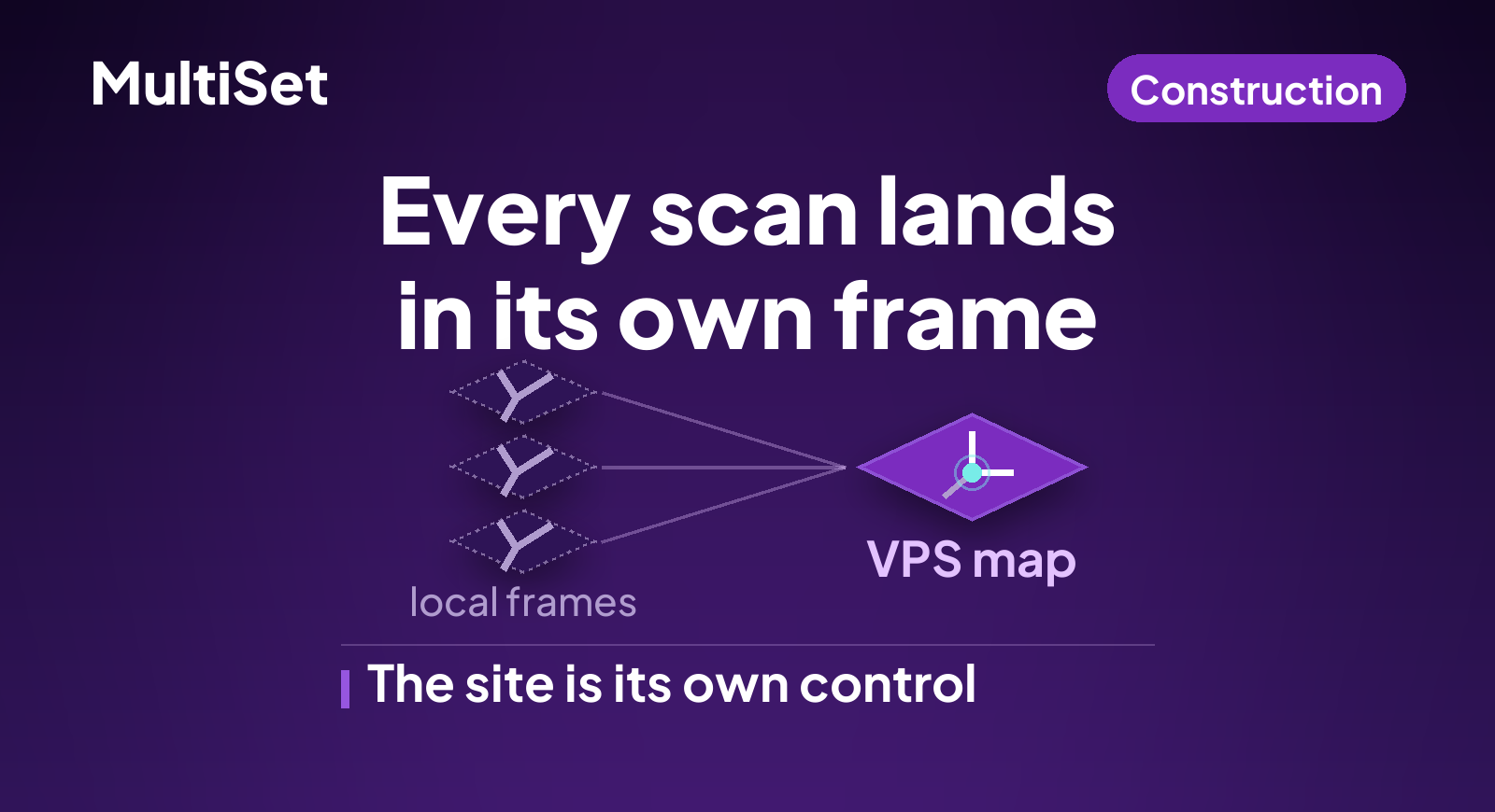
The core issue is straightforward. Each 360° scan produces a 3D reconstruction in its own local coordinate system. To compare scans across time, you need a precise transformation that aligns them all into one shared reference frame. Traditional methods weren't built for environments that change between captures.
The standard approach to aligning two 3D point clouds is Iterative Closest Point (ICP) and its variants. ICP works by iteratively matching nearest points between two clouds and minimizing the distance between them. It's powerful in static environments, aligning two scans of a finished building for example, but it assumes the underlying geometry hasn't fundamentally changed between captures.
On a construction site, that assumption is violated on every scan. Between capture sessions:
These changes mean ICP will try to match geometry that no longer corresponds, producing drift, false convergences, or outright failure.
Feature-based localization methods face similar challenges. When the visual and geometric characteristics of the environment change enough between scans, the features extracted from one session may have no reliable correspondences in the next. The result is the same: misaligned reconstructions that erode confidence in the change detection data downstream.
ChallengeTraditional ICPMultiSet VPSGeometry that changes between scansFalse convergenceHolds through the changeVarying lighting conditionsFeature matching failsLighting invariantTransient objects such as equipment and workersIntroduces noiseFilters transientsFalse positive alignment detectionNo built-in checkConfidence scoringRequires RTK or survey controlOften necessaryNot required
MultiSet's Visual Positioning System offers a fundamentally different approach. Instead of trying to match raw geometry between scans, it uses a persistent visual map as the common reference frame. The VPS is purpose-built to handle the exact conditions that break traditional alignment: changing geometry, variable lighting, moving objects, and visual clutter. Its AI-driven localization models identify stable structural features, the elements of a building that persist across construction phases, while filtering out transient elements that would corrupt the alignment.
The system provides both single-frame and multi-frame localization APIs. Single-frame localization returns a precise 6-DoF pose from one camera frame in about two seconds, ideal for quick spot checks. Multi-frame localization aggregates information across four to six images captured along a path and returns a consensus pose, which is exactly what's needed when localizing images extracted from a 360° scan walkthrough.
The system also includes confidence scoring and false positive detection. If the environment has changed so drastically that a reliable alignment can't be computed, the API will flag it rather than silently returning a bad transformation. This is critical for construction workflows where an undetected misalignment cascades into incorrect change reports, missed clashes, and erroneous progress claims.
Step 1 - Capture base scan and create VPS map
Conduct your first 360° scan of the site. Reconstruct it into a 3D model as normal. Upload the scan or reconstructed model to MultiSet, which creates your VPS Reference Map. This map becomes the persistent coordinate anchor for all future scans.
Step 2 - Conduct new 360° scan and reconstruct
Days or weeks later, perform your next site scan. Reconstruct it into 3D using your standard photogrammetry or SLAM pipeline. This new reconstruction exists in its own local coordinate system, unrelated to the baseline.
Step 3 - Send images and local coordinates to MultiSet VPS
Select a few images from the new scan along with their known local coordinates from the reconstruction. Send these to MultiSet's single-frame or multi-frame localization endpoint, targeting the VPS Map created in Step 1. The API computes each image's pose in the reference map's coordinate frame.
Step 4 - Compute precise transformation
You now have two sets of coordinates for the same images: their positions in the new scan's local frame and their positions in the reference map's frame. From these correspondences, compute the rigid transformation, rotation plus translation, that maps one coordinate system to the other. Apply this to the entire new reconstruction. Both scans are now in the same coordinate space at centimeter accuracy.
Step 5 - Repeat for every new scan
Each subsequent site scan follows the same process. Reconstruct, localize a few images against the reference VPS Map, compute the transformation, align. Over weeks and months, every scan snaps into the same unified coordinate space, enabling precise 4D change detection across the entire project lifecycle.
The integration into an existing scan-to-reconstruct pipeline is straightforward. After reconstruction, your pipeline extracts a handful of images and their computed local poses, then calls MultiSet's query endpoint. Single-frame uses /vps/map/query; multi-frame uses /vps/map/multi-image-query and takes four to six frames.
// For each selected image from the new scan:
POST /vps/map/query

{
  "image": "base64_encoded_image",
  "hintPosition": {
    "x": 12.45,    // local coords from reconstruction
    "y": 3.20,
    "z": 1.50
  }
}

// Response: pose in the VPS Map's coordinate frame
{
  "poseFound": true,
  "confidence": 0.94,
  "position": { "x": 48.12, "y": 7.85, "z": 1.48 },
  "rotation": { "qx": 0.01, "qy": 0.72, "qz": -0.01, "qw": 0.69 }
}
The position hint narrows the search to a default radius of 25 m, and hintRadius tightens or widens that between 5 and 100 m. Frames are capped at 1280 px on the longer side.
With matched pose pairs, local frame to map frame, for several images, a least-squares rigid body estimation yields the optimal transformation matrix. Apply it to the entire reconstruction, and the new scan is aligned to the reference.
The API returns a confidence score with every localization. If the score falls below a threshold, and production teams commonly use 0.7, the alignment is flagged for review rather than silently accepted. That prevents bad transformations from corrupting the change detection pipeline.
Once every scan lives in a shared coordinate space, the comparison becomes trivial, and the value compounds with every capture cycle.
Automated progress tracking
Overlay the latest scan against the BIM model or the previous week's capture. Differences surface automatically. New concrete poured, framing completed, MEP rough-in progress. Project managers get quantifiable progress metrics without manual interpretation of photographs or walkthroughs.
Clash and deviation detection
With centimeter-accurate alignment, as-built deviations from the design model become visible before they compound into costly rework. A pipe installed 3 cm off-spec, a wall that's drifted from plumb: these issues are detectable in the aligned scan data long before they'd surface through visual inspection alone.
Change order documentation
Every aligned scan becomes a timestamped, spatially-accurate record of the site. When disputes arise over what was built when, the aligned scan sequence provides unambiguous evidence, far more defensible than photographs or daily logs.
No RTK dependency
Traditional survey-grade alignment on construction sites often requires RTK GPS base stations, total stations, or manually surveyed control points. MultiSet's visual localization achieves centimeter accuracy using the site's own visual structure as the reference, with no additional survey infrastructure required. This is particularly valuable for interior spaces where GPS signals are unavailable.
Construction is one of the least digitized industries in the world. The tools and workflows for reality capture are improving rapidly, with 360° cameras, photogrammetry and LiDAR scanning, but the spatial intelligence layer that makes captured data comparable across time has lagged behind. Aligning scans done days apart in a changing environment has remained a manual, error-prone process that limits the value of the entire reality capture investment.
VPS changes the equation. It provides a persistent, visually-anchored reference frame that holds through exactly the kinds of changes construction sites produce, which turns periodic scans from isolated snapshots into a continuous, spatially-coherent record of the project. The downstream effects, better progress tracking, earlier deviation detection, defensible documentation and reduced rework, compound over the life of a project.
And because MultiSet's VPS is scan-agnostic, it works regardless of what capture hardware or reconstruction software a team uses. Matterport, Leica, NavVis, iPhone LiDAR, drone photogrammetry: the same VPS map is the alignment anchor for all of them.