MultiSet Visual Positioning System (VPS) supports Third-Party scans
- Nikhil Sawlani
- Feb 17
- 3 min read
Updated: Mar 3
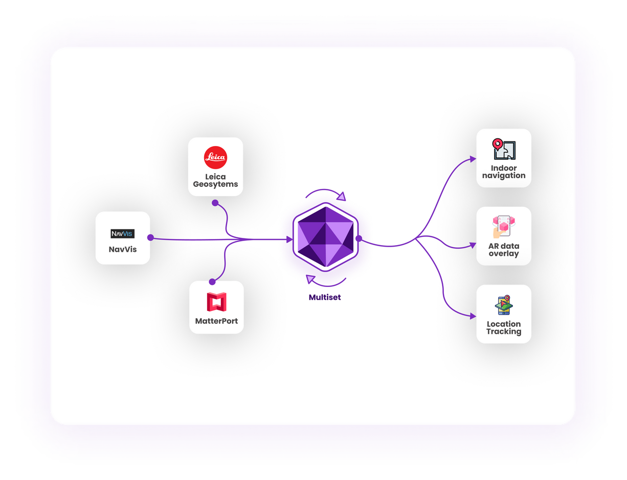
We are excited to announce an important feature in our MultiSet Visual Positioning System (VPS): seamless support for localization in third-party maps using E57 files, including data from Matterport, NavVis, and Leica scans. Whether you’re working with a sprawling factory floor, a bustling shopping mall, or a stadium filled with tens of thousands of seats, MultiSet VPS can now provide reliable, centimeter-level localization on these diverse mapping platforms.

Why E57 Support Matters
E57 is a widely-adopted industry standard for storing 3D imaging data. By supporting E57 files, MultiSet VPS makes it easier than ever to integrate and localize across numerous scanning solutions:
Matterport for immersive 3D tours
NavVis for wide-area reality capture
Leica for high-precision, professional-grade scans
This interoperability simplifies workflows, letting you capture once and localize everywhere.
Key Requirements for Accurate Localization
Before you begin, ensure these best practices are followed to maximize accuracy and reliability of mapping:
Panoramas Must Be Included
Make sure each area has multiple overlapping images. This greatly enhances the VPS’s ability to recognize unique visual features and deliver robust localization.
Higher ‘Scan Points’ Density for Matterport
Matterport captures are already known for their immersive experiences, but for VPS localization, a higher density of scan points than typical tours is recommended. The richer your point cloud data, the better your results.
Point Cloud Density: Low or Medium
When exporting E57 files, choose low or medium density. These settings strike the best balance between file size and detail, ensuring efficient processing and high accuracy.
Standout Features
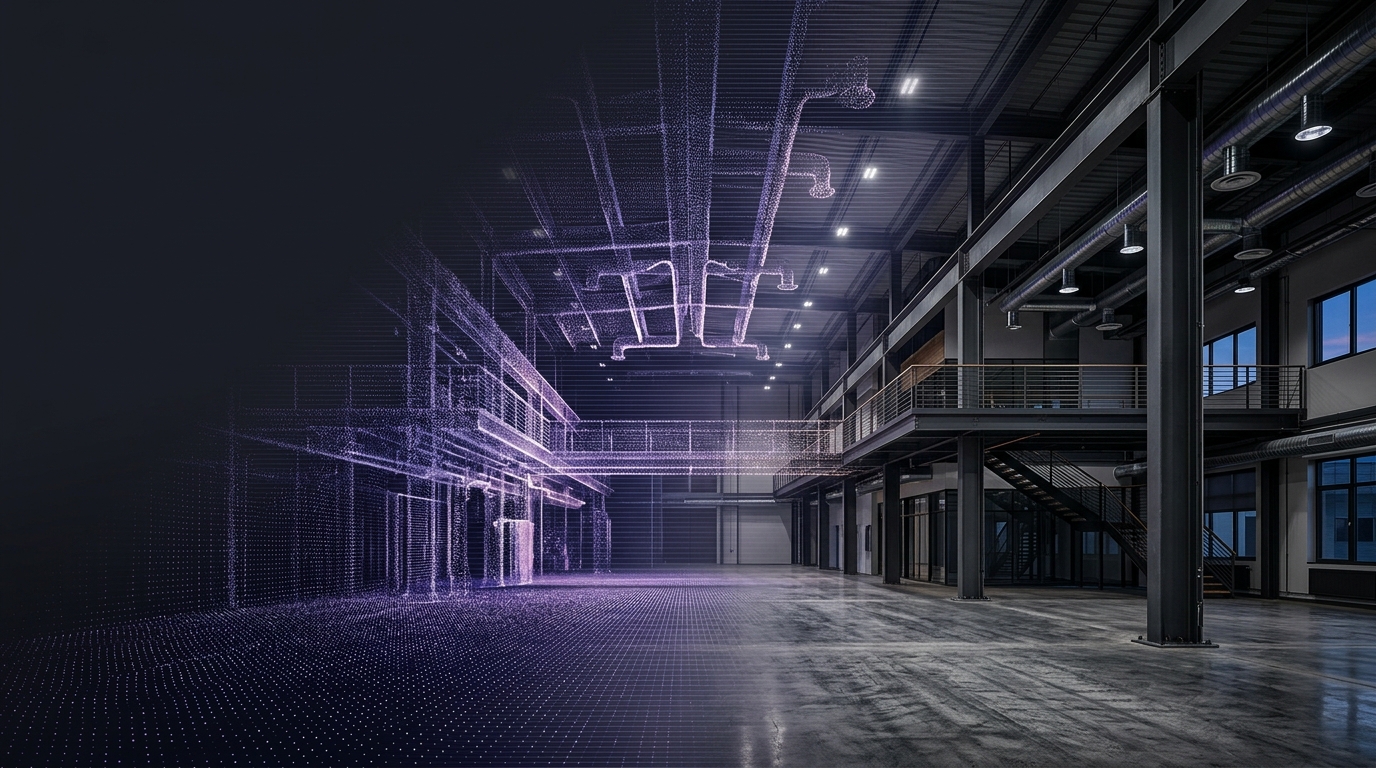
1. State-of-the-Art Localization Accuracy (<10 cm)
Achieving under 10 cm accuracy is critical for many industrial, commercial, and public-facing applications. MultiSet VPS leverages advanced computer vision and SLAM (Simultaneous Localization and Mapping) algorithms to deliver precise localization in real-world spaces. Whether you’re guiding robots in a warehouse or offering AR-guided tours in a museum, accuracy is paramount—and we’ve got you covered.
2. Indoor and Outdoor Versatility
From factory floors with complex machinery to open-air stadiums accommodating thousands of visitors, MultiSet VPS is robust enough to handle them all. By integrating panoramic images and point cloud data, we can effectively localize devices and users in dynamic environments, both indoors and outdoors.
3. Instant WebAR Localization
Augmented Reality is no longer confined to specialized apps. Thanks to MultiSet VPS, you can now enable WebAR localization—meaning your audience can instantly engage with AR experiences right in their mobile browser. This opens doors for interactive wayfinding, product showcases, or guided tours without the need for a standalone application.
4. Flexible Map Processing: On-Cloud or Offline
We understand that data privacy and security are paramount. That’s why we offer two modes of map processing:
On-Cloud: Leverage our scalable infrastructure for rapid processing of large E57 datasets.
Offline: For sensitive or proprietary environments, run the map processing securely on your own servers or offline systems.
Capture
Use Matterport, NavVis, Leica, or any other E57-compatible scanner to capture 3D data. Ensure you’ve included overlapping panoramic images and, if using Matterport, increased scan density.
Export to E57
Export the complete dataset—including panoramas—using the recommended low or medium point cloud density.
Import into MultiSet VPS
Upload your E57 file to MultiSet VPS—either in the developer portal or offline. Our system automatically ingests and preprocesses the data, identifying key visual features and building a robust localization map.
Deployment & Localization
Once processed, deploy the MultiSet VPS plugin or SDK in your chosen environment. Users can instantly localize themselves (and any AR experiences) in the scanned space with sub-10 cm accuracy.
Manufacturing & Warehousing: Track autonomous robots, guide workers with AR overlays, or monitor equipment in sprawling industrial sites.
Retail & Shopping Malls: Offer interactive AR maps to shoppers for easy navigation and personalized deals.
Office Campuses: Enable contactless navigation for visitors, or assist with facility management across multiple floors.
Event Venues & Stadiums: Provide immersive tours, seat-finding solutions, and real-time location-based advertising.
Museums & Exhibitions: Create AR-guided tours that bring artifacts to life, enhancing educational experiences.
Getting Started
Check Scanner Settings: Verify that your scanner is set to capture panoramas with adequate overlap.
Adjust Density: For Matterport, increase the number of scan points. For all systems, choose low/medium point cloud density when exporting.
Upload Your E57: Import the file into MultiSet VPS via our Developer portal or offline setup.
Deploy & Innovate: Integrate our localization SDK into your app or web app to immediately enjoy accurate, reliable AR and navigation experiences.
Complete Tutorial
Stay tuned for more updates as we continue to evolve MultiSet VPS, bringing new functionalities, integrations, and optimizations to all our users. Together, let’s redefine spatial computing and make localization simpler, faster, and more accurate than ever!
Comments